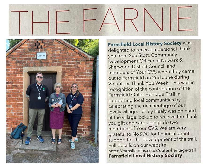
Welcome to the Farnsfield Local History Society

The main trail map is a longer walk around the village taking in heritage points along the way. Following the trail is made easier by the addition of “way point” direction photos to keep you on track. We also include refreshment points along the route, which may be a café, pub etc.The entire route can be downloaded to browse offline or to add to your phone. A QR code will also give your phone the link to use as a map along the walk.Added to this page is a series of shorter loops, which offer a “bite size” portion of the trail. The central loop 2 is also more “mobility” friendly, whereas the other two loops require traversing more difficult terrain and high gates/stiles.We will have “Heritage points“ along your route and these will give historical background to your location and further links to longer in-depth information.When you are walking the trails and note improvements or errors – please let us have feedback via the contact page. We hope you enjoy seeing the great heritage points around the village. |
|---|

The Outer Heritage Trail printed leaflet is available to download. Funding for this leaflet development was kindly given by Newark & Sherwood District Council with design and content by Sherwood Solutions Ltd.
Click on the link here to view/print the leaflet

QR Code to open the outer trail on a portable device
Outer Heritage Trail


Outer Trail Start
Southwell Trail car park, Station Lane, Farnsfield NG22 8LB

South Lodge
South Lodge Entrance to the Hexgreave Estate Go through the gate, South lodge is on your left then continue ahead to the "T" junction.
Turn left on Broomfield Lane
Turn right at the junction

Option 1 go left through hedge or option 2 continue on the road

Continue across the field
Option 2: Turn left at the 2nd bend up lime tree avenue

Reach the stile next to the road
With option 2 - the stile is on your left along the road

Hexgreave Hall
Look for the Old Boiler Room Café (green roof) - across the car park

Footpath sign - turn right
Cross the grass to the gate

Deer park gate
Go through the gate.
Look for the Deer
Look back at Hexgreave Hall
Go through exit gate - then cross the high stile
Cross the stile and onto the road

Follow the yellow markers on the road

At the metal gate - go right at the yellow way marker
cross the field, looking back to view Lower Hexgreave Farm

Continue through the field
Reach the crossing with the Southwell trail. go straight on

Cross the path to Brickyard Lane
A pebbled path

Farnsfield Waterworks
On your right along the lane

Waterworks house
Originally two cottages

Hexgreave Hall
Look to your right - Hexgreave Hall
Left to the Main St - cross with care

Parfitt Drive
Maple and Oak Trees - for Halifax Bomber crew. Drive named after Pilot Officer Reginald Parfitt

Old Boiler Room Café
Café (green roof) - open during business hours
https://oldboilerroom.co.uk

Pathway to Cotton Mill Lane
Take the pathway on the left. You will emerge onto a bridleway- Cotton Mill Lane. Turn right, follow the lane to the junction with Quaker Lane.

Woodberry Café
Café closed Mon - Tue

Quaker lane detour
Turn right onto Quaker Lane to the house where the gas works manager lived (1900s). The garden led direct to the gasworks grounds. Next to vine cottage, the modern house (L) is the site of the gasometer.

Vine Cottage
Next to vine cottage, the modern house (L) is the site of the gasometer.

Victorian Terraced Cottages (3)
3 Cottages - part of the gasworks development 1869.

Tippings Lane Junction
Continue onto Combs Lane - sign for Halifax Bomber Memorial
At the sign for Memorial site follow the track to the left

Halifax Bomber Memorial
After visiting - retrace steps to Combs lane and turn right

Turn left onto footpath
cross the field and through a gate. The second field slopes along a fenced track

Fence track
Good views to the church and Farnsfield Hall

Birdcage walk
the footpath leads to Blidworth Road

The Green
Saddler's cottage left. Lime tree - site of the village maypole. The "Lion" pub - keep left past the pub on Mansfield road

Farnsfield Hall
View of Farnsfield Hall from across the fields
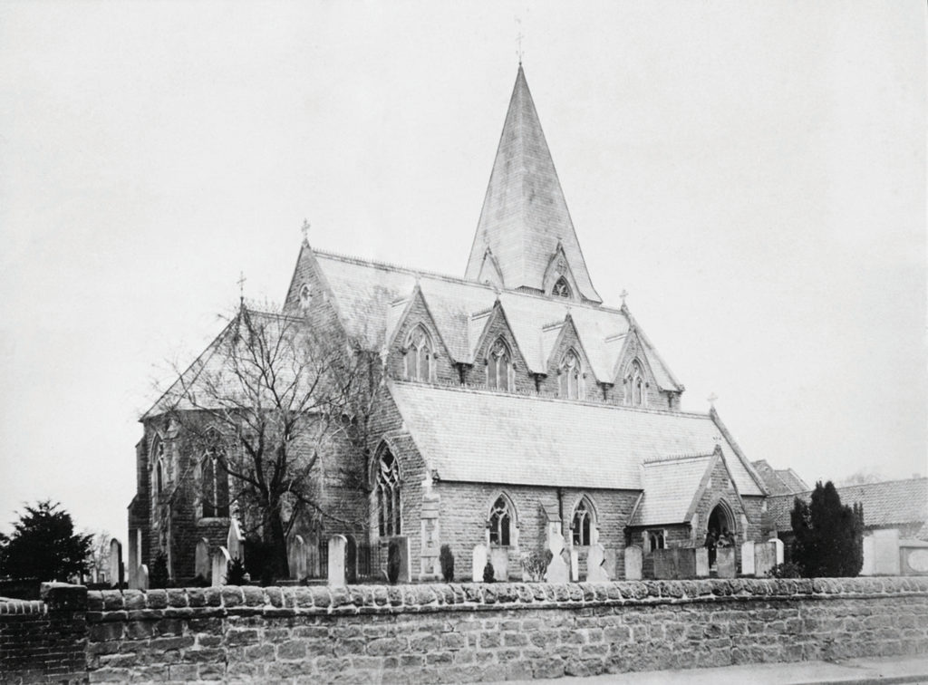
The Church
The Church can be seen from across the fields
Option 1. Past the bus stop go left thro' gate across Bells Field

Turn right through the gate
continue along the lane past the Vicarage

The Old Vicarage
continue along the lane past the Vicarage on your left

Robin Hood Way
Across the fields to the right is Mill House. Behind stood the "Good Intent Windmill"

The Stile at the end of the final field
Cross the stile to the A614 verge - turn right and walk down the edge to the White Post Inn
TAKE CARE!! Fast moving traffic

The fenced path rises and narrows
Keep to the right of the fence. When you see the Public Footpath sign turn right onto the Southwell Trail
Cross over the road keep right up the hill - go past Rufford Garage

White Post Farm
Follow the Southwell trail. looking right you may see animals at the White Post Farm

Old Rail Bridge
Continue under the old Railway Bridge

Old Goods Shed and Car Park
200m after the bridge - look right for the old Goods shed and the Car park - Trail Ends.

The White Post Inn
Pub - Refreshments

Option 2. Shorter loop
Cross the road at the bus stop and continue along Mansfield Road - past the "Lock up"
Option 2. Mill House
Behind Mill house (orig. 3 cottages) was "Good Intent Windmill"

Option 2. White Post
Continue past White Post Farm and turn right at the roundabout to re-join the outer trail
Warning - Care Walking along A614

Heritage Point
Old Railway History
Heritage Point
The Old Pubs of Farnsfield
(c) OpenStreetMap ( Openstreetmap copyright )
Outer Trail loop 1

Outer Trail Loop 1 Start
Southwell Trail car park, Station Lane, Farnsfield NG22 8LB
South Lodge
South Lodge Entrance to the Hexgreave Estate Go through the gate, South lodge is on your left then continue ahead to the "T" junction.
Turn left on Broomfield Lane
Turn right at the junction
Option 1 go left through hedge or option 2 continue on the road
Continue across the field
Option 2: Turn left at the 2nd bend up lime tree avenue
Reach the stile next to the road
With option 2 - the stile is on your left along the road

Swan Lodge
Look for the crenelated gable ends & large chimney stacks
Hexgreave Hall
Look for the Old Boiler Room Café (green roof) - across the car park
Footpath sign - turn right
Cross the grass to the gate
Deer park gate
Go through the gate.
Look for the Deer
Look back at Hexgreave Hall
Go through exit gate - then cross the high stile
Cross the stile and onto the road
Follow the yellow markers on the road
At the metal gate - go right at the yellow way marker
cross the field, looking back to view Lower Hexgreave Farm
Continue through the field
Reach the crossing with the Southwell trail. Turn right onto the trail
Turn right onto the Southwell Trail
Hardcore path
Farnsfield Waterworks
On your left along the trail
Hexgreave Hall
Look to your right - Hexgreave Hall
Old Boiler Room Café
Café (green roof) - open during business hours
https://oldboilerroom.co.uk
Cross over Broomfield Lane back to the start
Outer Trail loop 2

Turn tight - Parfitt Drive Parking
Maple and Oak Trees - for Halifax Bomber crew. Drive named after Pilot Officer Reginald Parfitt
Pathway to Cotton Mill Lane
Take the pathway on the left. You will emerge onto a bridleway- Cotton Mill Lane. Turn right, follow the lane to the junction with Quaker Lane.
Woodberry Café
Café closed Mon - Tue
Quaker lane detour
Turn right onto Quaker Lane to the house where the gas works manager lived (1900s). The garden led direct to the gasworks grounds. Next to vine cottage, the modern house (L) is the site of the gasometer.
Vine Cottage
Next to vine cottage, the modern house (L) is the site of the gasometer.
Victorian Terraced Cottages (3)
3 Cottages - part of the gasworks development 1869.
At the sign for Memorial site follow the track to the left
Halifax Bomber Memorial
After visiting - retrace steps to Combs lane and turn right
Turn left onto footpath
cross the field and through a gate. The second field slopes along a fenced track
Fence track
Good views to the church and Farnsfield Hall
Birdcage walk
the footpath leads to Blidworth Road
The Green
Saddler's cottage left. Lime tree - site of the village maypole. The "Lion" pub - keep left past the pub on Mansfield road
Farnsfield Hall
The Church
Parking
Tippings Lane Junction
Continue along Combs lane towards the Halifax memorial
Outer Trail loop 3

Outer Trail Start
Southwell Trail car park, Station Lane, Farnsfield NG22 8LB
Once parked, proceed back along the lane you came in on.
The Old Vicarage
Continue along the lane past the Vicarage on your left
White Post Farm
Follow the Southwell trail. looking right you may see animals at the White Post Farm
Old Rail Bridge
Continue under the second old bridge (Cockett lane) towards the old goods yard
Old Goods Shed
Going past the Old goods yard. follow the path right back to the car park (can be seen from the path).
The White Post Inn
White Post Inn - Refreshments
Option 2. Mill House
Behind Mill house (orig. 3 cottages) was "Good Intent Windmill"
Option 2. White Post
Option to shorter route. Continue right at the roundabout up the hill using the footpath by the Nursery.
Warning - Take care walking near A614
Footpath to the White Post roundabout
Turn right at the signpost, up the steps, heading along the disused rail line

Cross the roundabout and keep left
uphill next to the busy A614 - look for the stile on your left
Go over the Stile
Go through the gap (Robin Hood Way)
and turn right keeping to the verge down to the roundabout, with the White Post Inn on the right. TAKE CARE - FAST CARS on A614

Across the fields
Listen for Skylarks and look for wild flowers and butterflies
Mill House seen left across the fields
Across the fields to the right - see Mill House, the white house was once 3 cottages and behind stood the good intent windmill (1920's)
Bells' field
Turn right through the gate and up the lane towards the Vicarage

The Lockup
Across the field to the ‘lias’ limestone paving - look for the lockup at the end of the path. Cross the road and next to the bus-stop go through the gate and cross Bell's Field.
Turn right and cross Wilson's recreation ground

Site of Whitehead's Windmill
Opposite Spring lane - the house entrance has the two original mill stones set into the wall.

Old Station house
At the car park entrance - the house on the right is the old station house (station master's house, waiting room and ticket office. Turn left onto Station Lane

Old Goods Shed
Now a private house - continue along the lane to Station lane